About Us
Mission
Research
Education
Planning
Restoration
Capabilities
Habitat Enhancement
Permanent Habitat Module
Non-Point Source Pollution Reduction
Urban Best Management Practices
Water Quality Monitoring Assessment and Remediation
Onondaga Lake Tributary Assessment
Microbial Trackdown Study
Mudboil Remediation Tully Valley
Onondaga Lake Water Quality Model Scientific Peer Review
Public Outreach
Onondaga Lake Community Education
Onondaga Lake Partnership Committees and OEI
Environmental and Community Planning
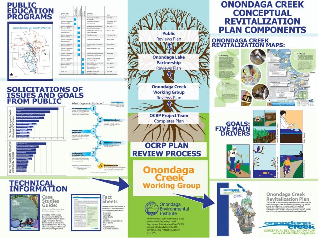
The Onondaga Creek Conceptual Revitalization Plan
Corporate History
Our Board of Directors
Our Team
Accomplishments
Opportunities
Affiliates
Our Watershed
Definition of Watershed
History
Onondaga Lake
Tributaries
Onondaga Lake Portal
Projects
Resources
Free Use Policy
Maps and Graphics
Publications
Curriculum & Teacher Tools
Fact Sheets +
Videos
Photo Gallery
Topics
References, Sources, and Citations
News
Contact Us
COVID-19: OEI Update
About Us
Mission
Research
Education
Planning
Restoration
Capabilities
Habitat Enhancement
Permanent Habitat Module
Non-Point Source Pollution Reduction
Urban Best Management Practices
Water Quality Monitoring Assessment and Remediation
Onondaga Lake Tributary Assessment
Microbial Trackdown Study
Mudboil Remediation Tully Valley
Onondaga Lake Water Quality Model Scientific Peer Review
Public Outreach
Onondaga Lake Community Education
Onondaga Lake Partnership Committees and OEI
Environmental and Community Planning
The Onondaga Creek Conceptual Revitalization Plan
Corporate History
Our Board of Directors
Our Team
Accomplishments
Opportunities
Affiliates
Our Watershed
Definition of Watershed
History
Onondaga Lake
Tributaries
Onondaga Lake Portal
Projects
Resources
Free Use Policy
Maps and Graphics
Publications
Curriculum & Teacher Tools
Fact Sheets +
Videos
Photo Gallery
Topics
References, Sources, and Citations
News
Contact Us
COVID-19: OEI Update
Donate Now
Maps and Graphics
Home
/
Resources
/
Maps and Graphics
Back To Home
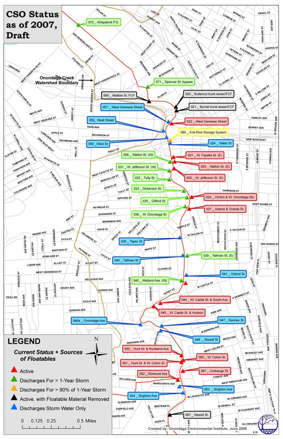
Combined Sewer Overflow Points along Onondaga Creek within the City of Syracuse as of 2007
The Onondaga Creek Conceptual Revitalization Plan Diagram
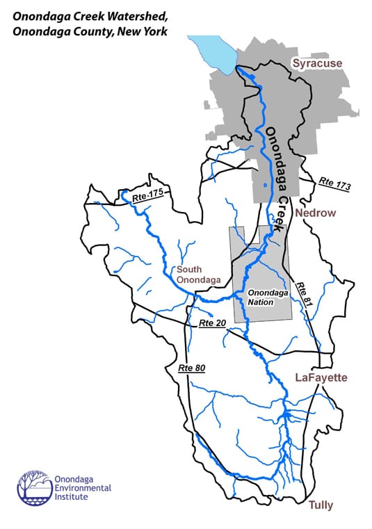
The Onondaga Creek Watershed
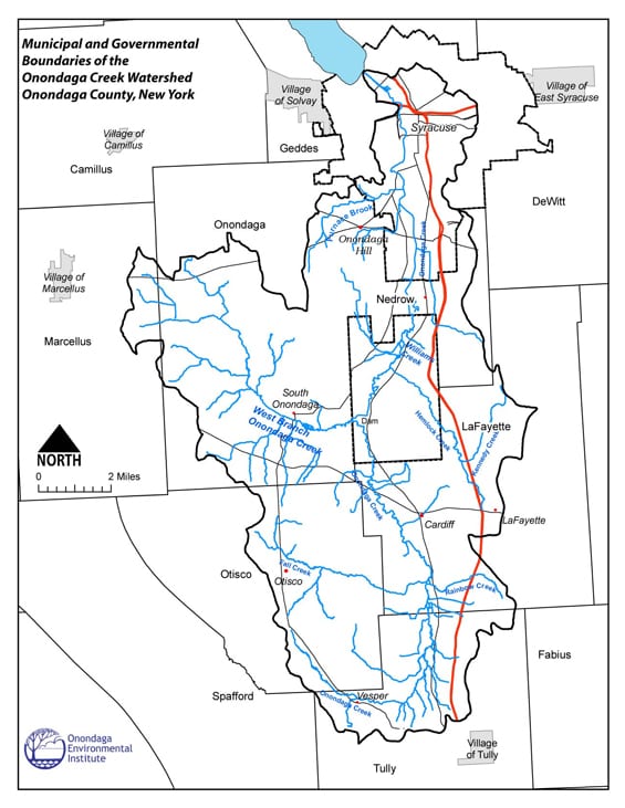
Municipal and Governmental Boundaries of the Onondaga Creek Watershed
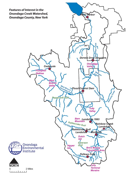
Features of Interest in the Onondaga Creek Watershed
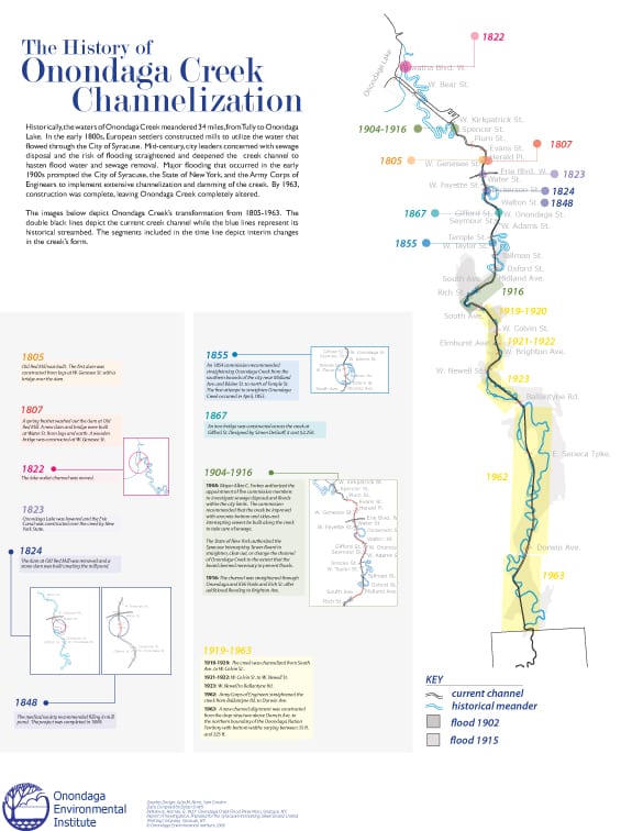
The History of Onondaga Creek Channelization
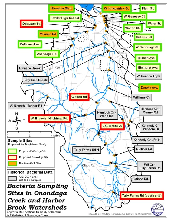
Microbial Trackdown Study: Onondaga Creek Watershed Sampling Locations
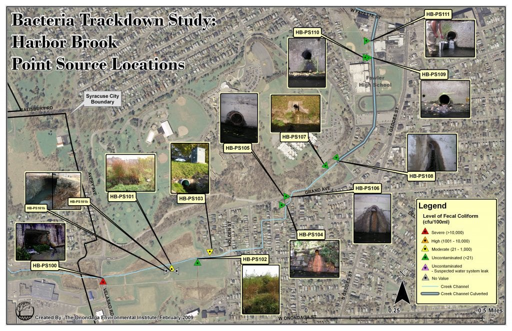
Microbial Trackdown Study: Harbor Brook Point Source Locations
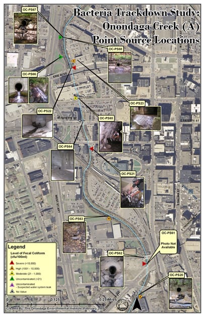
Microbial Trackdown Study: Onondaga Creek Point Source locations North of West Onondaga Street
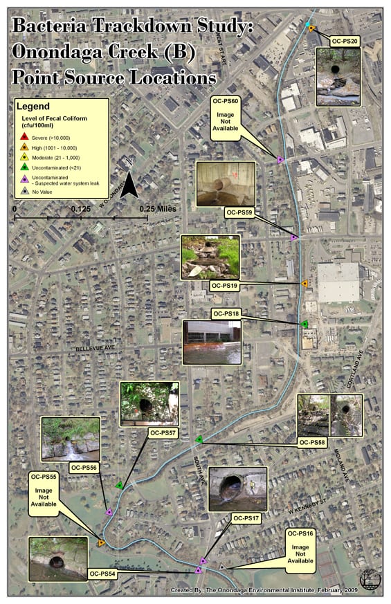
Microbial Trackdown Study: Onondaga Creek Point Source locations North of Colvin Street and South of West Onondaga Street
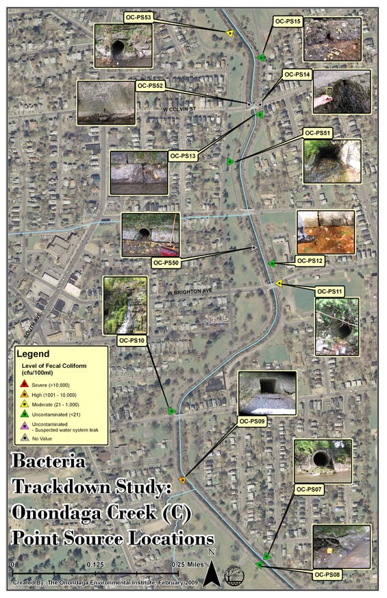
Microbial Trackdown Study: Onondaga Creek Point Source locations South of Colvin Street
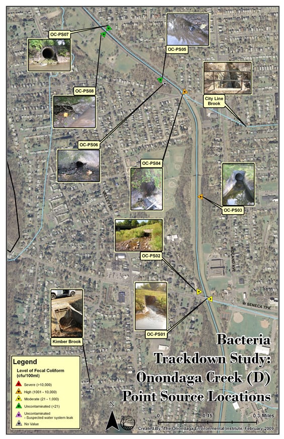
Microbial Trackdown Study: Onondaga Creek Point Source locations South of Newell Street
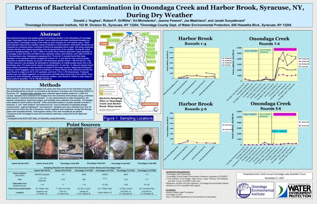
Patterns of Bacterial Contamination in Onondaga Creek and Harbor Brook, Syracuse, NY During Dry Weather
Modal title
×
Your name
District/Organizational Affiliation
Your email